I think we can all agree that the national parks in the United States are breathtakingly beautiful and chock-full of opportunities to get outdoors in some of the most dramatic settings on earth.
The downsides to national park visits are the endless traffic jams, crowded trails, and hustling you have to do to score the last campsite or a permit to hike your favorite trail.
Sure there are ways to bypass these issues, but sometimes you just have to hit up the Grand Canyon when your kids are on school vacation.
I’m definitely not going to advocate for skipping a visit to these national treasures, but I do want to suggest some alternatives for those days when you just need a break from the throngs of people and cars waiting in long lines to catch a glimpse of a lonely moose meandering across a field.
My suggestion? Explore your national parks with every bit of your heart and soul. BUT, when the going gets rough and the crowds are just too much, I’ve got an alternative — awesome mountains, forests, canyons, campgrounds, vistas, and wildlife that are every bit as amazing as the national parks that we know and love.
I’m talking about YOUR national forests, and they are treasures beyond measure.
Why National Forests are Awesome
National Forests often go unnoticed by the millions of people driving through them on their way to the most iconic national parks. These incredible recreation areas offer opportunities for everyone to get outside.
Most national forests are free to visit and very inexpensive to camp in. Here are a few more things you may not realize about America’s amazing national forests:
- The United States has 154 national forests covering 294,275 square miles (source).
- There are only 10 states without a national forest (source).
- 70% of Americans live within 100 miles of a national forest (source).
- National forests are dog-friendly! Most national parks have restrictions on dogs to protect sensitive wildlife. It is much easier to visit national forests with dogs.
- Dispersed camping outside of developed campgrounds is usually free in national forests.
- Front-country camping in developed campgrounds varies from free to $30 per night.
- National forests contain 136 scenic byways stretching for more than 9,000 miles — a road tripper’s dream! (source)
Incredible National Forests Near Our Favorite National Parks
If you find yourself overwhelmed by traffic and crowds in your favorite national park, or you can’t get a permit for your favorite trail, or a spot at your favorite campground, don’t despair. Many of the most popular national parks in the US are surrounded by beautiful national forests where you can find solitude and wide-open spaces.
Nantahala National Forest Near Great Smoky Mountains National Park
Best time to visit: October is gorgeous for fall foliage and fewer crowds, but usually still warm enough to camp.
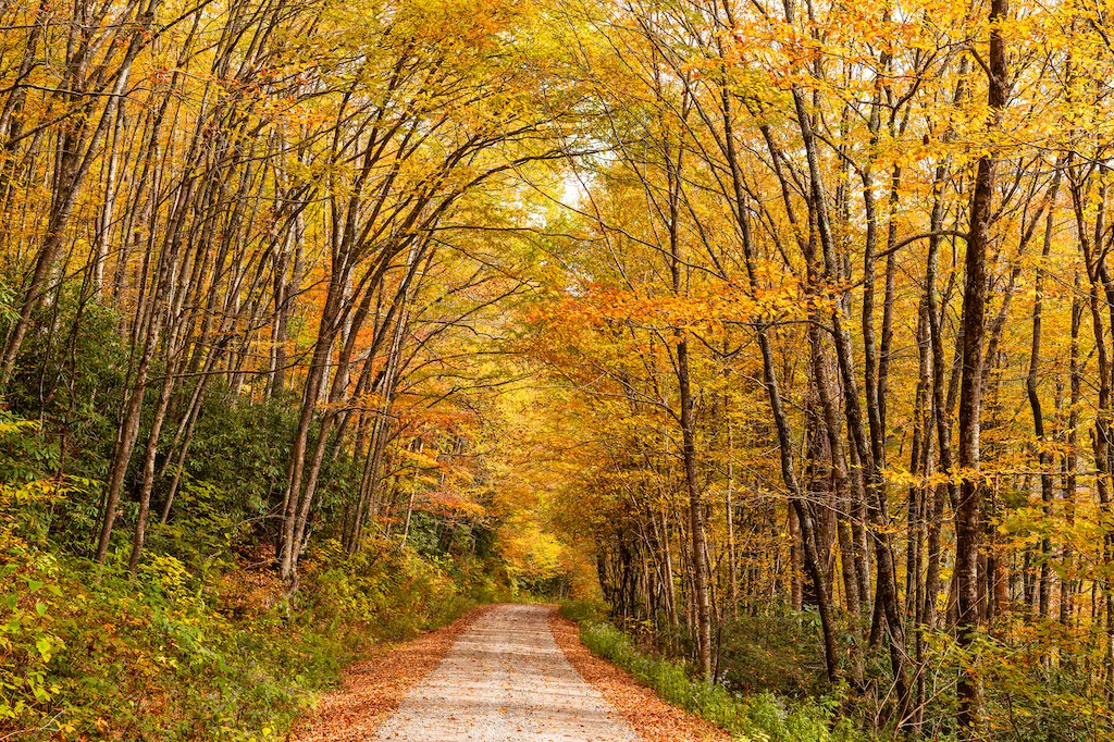
Did you know that Great Smoky Mountains National Park saw a record number of visitors in 2021? More than 14.1-million visitors explored the park, making it the most-visited national park in the system.
We can’t blame anyone for wanting to visit this special park, but if the crowds become overwhelming, you’ve got options!
Cherokee for “land of the noonday sun,” Nantahala National Forest encompasses 531,158 acres in western North Carolina, just south of Smoky Mountain National Park. Yes, Nantahala National Forest does get some of the overflow traffic from the Smokies, but there’s plenty of room to spread out and find solitude!
The incredible Blue Ridge Parkway winds through Nantahala National Forest, so if you’ve been wanting to drive this amazing stretch of pavement, now is the time to plan your trip.
Highlights of Nantahala National Forest
Santeetlah Lake: With a full-time population of just 40 as of the 2020 census, Santeetlah Lake offers plenty of opportunities for solitude, reflection, and recreation. The 2,800-acre lake is an oasis for boaters, anglers, paddlers, and floaters.
Highlights of this paradise include Cheoah Point Campground, with campsites overlooking the massive lake, and the Wauchecha Bald Trail, which offers up breathtaking scenic vistas and connects you to the world-famous Appalachian Trail. The trail is rated as strenuous, and the path is shared by hikers and mountain bikers.
Standing Indian Mountain and Campground – According to Cherokee mythology, Standing Indian Mountain is the remains of a warrior who turned to stone because he failed to remain at his post. In the Cherokee language, it is called Yunwitsule-nunyi, which means “where the man stood.” At 5,499 feet, the summit of Standing Indian Mountain offers a panoramic view of the surrounding landscape. The trail to the summit is part of the Appalachian Trail System.
During April and May the trail, shelters, and campgrounds become populated with northbound thru-hikers. A minor inconvenience for those seeking solitude, but thru-hikers are generally an amazing bunch of folks, and we’ve always found it a pleasure to spend time with them when we can. Standing Indian Campground is located on the headwaters of the Nantahala River, where you can cool off on a hot summer day.
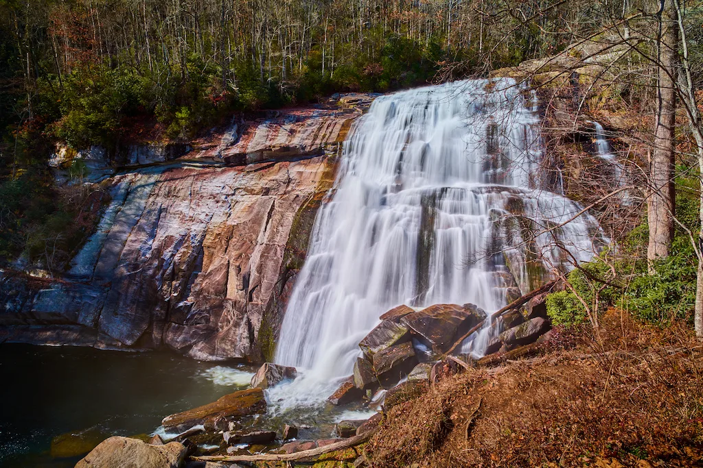
Gorges State Park – This spectacular and underutilized park is located on the North Carolina-South Carolina border. It is characterized by plunging waterfalls, gorges that cut deep into the earth’s crust, sheer rock walls, and rare wildlife.
Primitive camping is available, along with rugged (definitely not casual) hiking. Horses and mountain bikes are permitted on certain trails. Bring your camera for this one, folks — you just never know what secrets you’ll uncover here.
Dixie National Forest Near Zion National Park
Best time to visit: April and May are beautiful, with mild temperatures and fewer crowds.
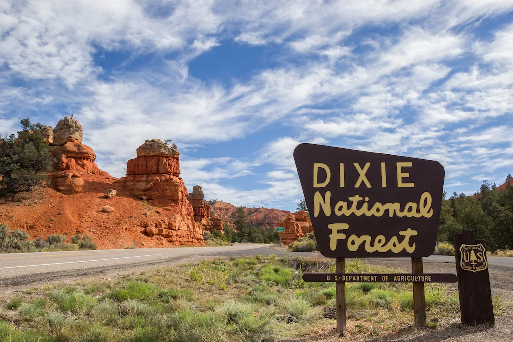
High mountain forests, beautiful alpine lakes, and deep desert canyons characterize Dixie National Forest, which encompasses more than two million acres. This is the largest national forest in Utah, and there are ample opportunities for hiking, mountain biking, and camping throughout.
The Cedar City Ranger District is located just north of Zion National Park. I recommend doing a scenic loop drive from Zion to Cedar City, southeast on Route 14 (closed in the winter), and back to Zion. It’s about 150 miles and really gorgeous. Here’s a map of the route.
Highlights of Cedar City Ranger District in Dixie National Forest
Ashdown Gorge Trail: Located right off of Route 14, this challenging river hike totals 8.8 miles (round-trip), but you can turn around whenever you like to make it shorter. The scenery here is comparable to Zion, and the hike is actually quite similar to the famous Narrows Hike in the national park. It’s technical, with lots of rock hopping and cold water. Here’s a link to the AllTrails guide.
Zion Overlook: Just a roadside viewpoint on Route 14 with breathtaking scenery. 100% worth stopping and snapping a few photos!
Navajo Lake: If you’re passing through in the summer, you’ll absolutely want to stop for a dip in beautiful Navajo Lake. There’s a 12-mile mountain bike trail that loops around the lake, as well as Navajo Lake Campground, where you can pitch your tent or park your RV. Sites are very spread out for privacy. Some are close to the water and others are across the road.
Shoshone National Forest near Yellowstone National Park
Best time to visit: July through September
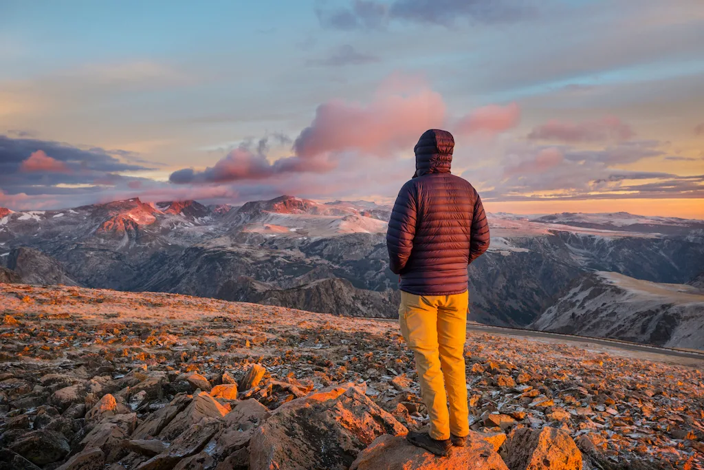
Just east of Yellowstone, you’ll find 2.4 million acres of snow-capped peaks, sagebrush flats, sprawling meadows, and expansive forests. Shoshone National Forest is a spectacular wilderness that was set aside in 1891 as the country’s first national forest.
Highlights of Shoshone National Forest
Chief Joseph Highway: Route 296 is known as the Chief Joseph Highway. It follows the route of the Nez Perce Indians and Chief Joseph as they fled from the US Cavalry in 1877.
The 46-mile route is spectacular (keep your eyes on the road). Head through at sunset and be sure to make use of the pull-offs, specifically Dead Indian Summit, so you can drink your fill of this beautiful world we live in. You’ll find patches of snow up here, even in the summer. Nothing beats a little snowball action in June to make you feel young again!
Cody, Wyoming: Named after “Buffalo Bill” Cody, the town of Cody embraces the wild west in a big way. You’ll find modern (if a bit touristy) dining and shopping opportunities, a myriad of nightlife venues, and several museums documenting everything from the life of Buffalo Bill Cody, wildlife, guns, and World War II, to art and murals of the western landscape. Western-themed lodges, ranches, cabins, and motels are plentiful in Cody, just be sure to reserve ahead of time in the summer.
Camping: If you’re looking to pitch your tent outside of Yellowstone for a night, a weekend, or even a week, Shoshone National Forest has plenty of options. Dead Indian Campground (no reservations) on route 296 is tiny and doesn’t see much use. The nearby trailhead will take you all the way up to Dead Indian Summit if you’re up for the challenge.
Beartooth Lake Campground (no reservations) on route 212 is a bit busier in the summer, perhaps because of its proximity to several beautiful mountain lakes and the incredible Beartooth Pass (10,947 feet).
Kaibab National Forest Near Grand Canyon National Park
Best time to visit: May or September/October
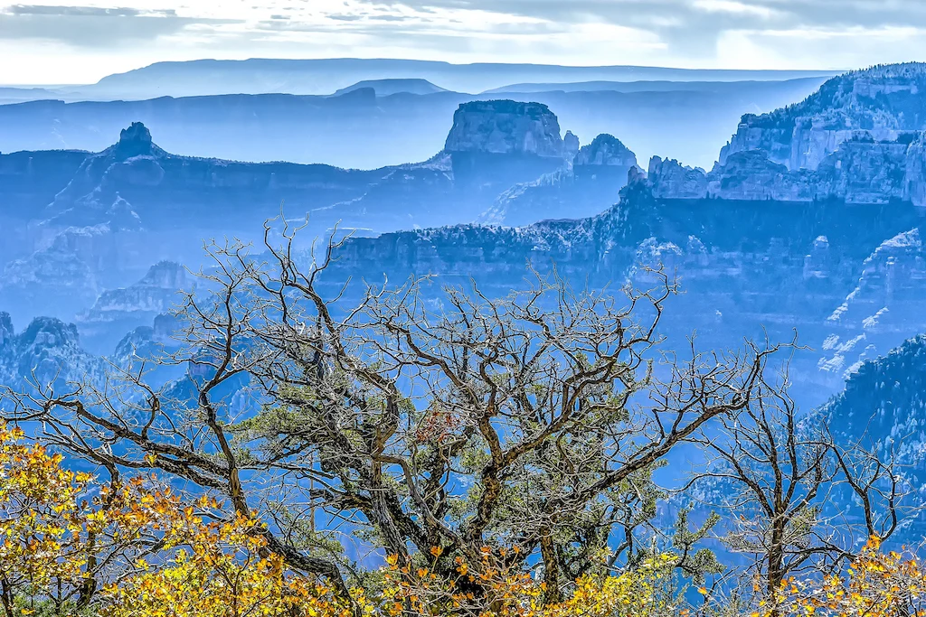
Bordering both the north and south rims of the Grand Canyon, Kaibab National Forest encompasses 1.6 million acres of canyons, mountains, and prairies in Northern Arizona. The climate and topography vary depending on whether you chose to explore the northern or southern Kaibab districts.
Highlights of South Kaibab National Forest
Hull Cabin: Built in the 1880s by settler William Hull, the Hull Cabin is one of the oldest structures in the area. It’s situated in a mature stand of Ponderosa Pines and can be reserved for your Grand Canyon getaway. The cabin sleeps up to six people and has a bedroom, living room, and kitchen. Reserve on Recreation.gov.
Grandview Lookout Tower: This 80-foot tall steel fire tower is the highest point on the South Rim. It was built in the 1930s — and now it marks a trailhead for the newly developed Arizona Trail.
Highlights of North Kaibab National Forest
Hiking on the High Kaibab Plateau: Bordering the North Rim of the Grand Canyon and the northern boundary of Grand Canyon National Park, the Kaibab Plateau is a flat, forested land formation with cliffs on three sides. The high point of the Plateau is 9,200′, and there are enough trails to keep you busy for days.
The Rainbow Rim Trail connects five viewpoints on the North Rim. This 18-mile trail can be done in smaller sections or as a backpacking trip. The hike from Timp Point to North Timp is a moderate 5.8-mile hike with decent shade and magnificent canyon views.
Jumpup Cabin: Located on the National Register of Historic Places, this cabin provides panoramic views of the Kanab Creek Wilderness on the edge of Jumpup Canyon. The cabin is two rooms with a composting toilet. Water is 1/4 mile away at the ranger station. Reserve on Recreation.gov.
Sierra National Forest Near Yosemite National Park
Best time to visit: May to September
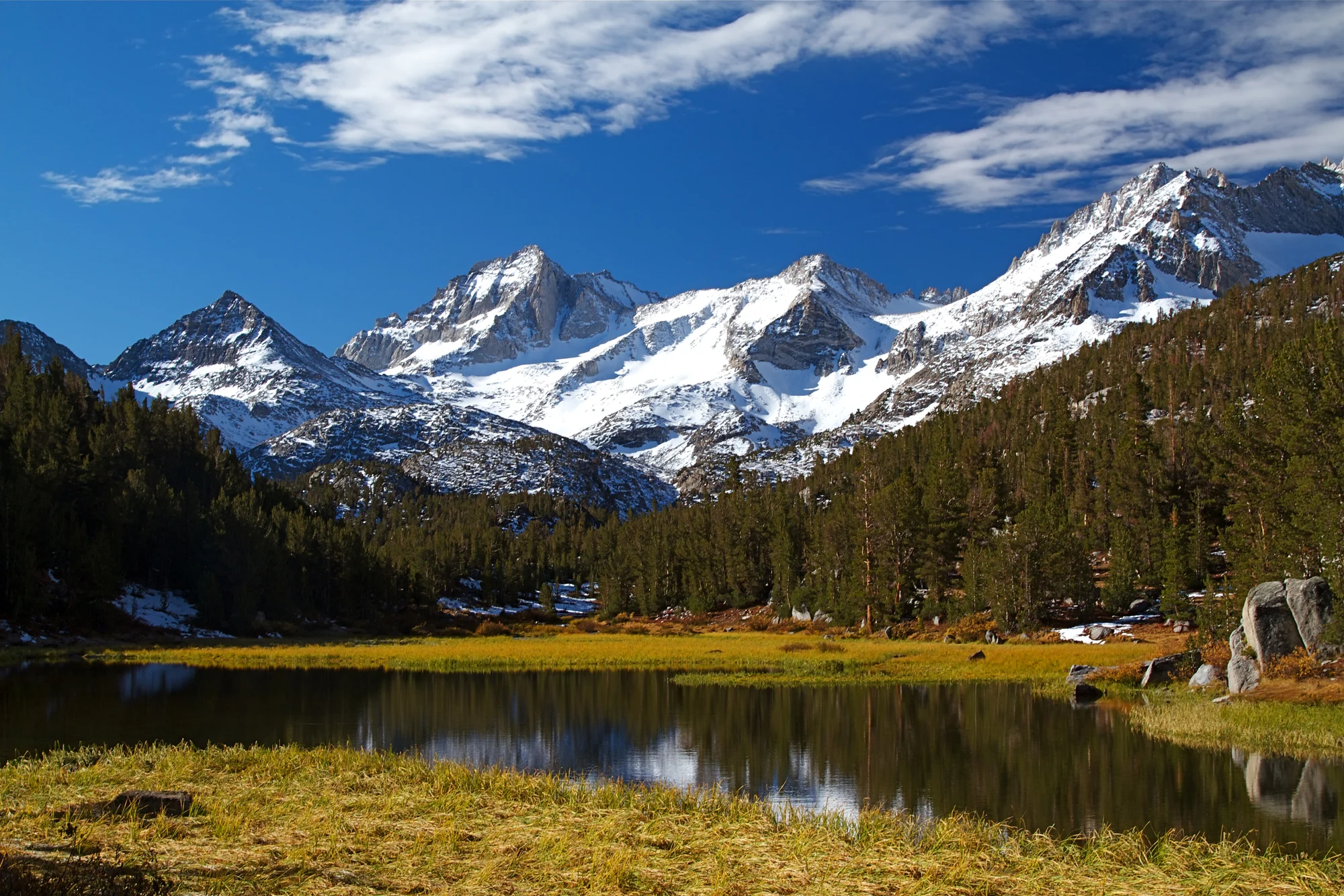
Just south of Yosemite is a vast wilderness covering approximately 1.3 million acres between 900 and 13,986 feet in elevation.
This slice of heaven is characterized by the alpine landscape of the High Sierras – meadows blazing with wildflowers, breathtaking scenic vistas, and cold, clear rivers, streams, and lakes. There are over a thousand miles of trails, groves of giant sequoias to explore, and even an abundance of secluded hot springs.
Ready to delve into this treasure? Grab a camera, and follow me.
Highlights of Sierra National Forest
Scenic Vista Byway: This 100-mile drive meanders through some of the most scenic landscapes in California. The whole route takes about five hours to complete, and there are plenty of stops along the way for hiking, picnicking, and camping.
The small and secluded Sweetwater Campground is a favorite — surrounded by running water that is as refreshing as it is beautiful. This is a great spot to find camping near Yosemite without the crowds. Be sure to stop at the Mile High Overlook for a dizzying view of the surrounding mountains. To plan your journey on the Scenic Vista Byway, check out the map.
Mono Hot Springs: Mono Hot Springs is not exactly getting away from it all, but you will find awesome primitive camping, a full-service resort, incredible hiking opportunities, and yes, beautiful hot springs. There’s a nice mix of developed and rustic pools. Some are super hot, others are just warm. Be prepared for some nudity or just get naked and embrace this awesome experience.
Nelder Grove: This sweet grove of giant sequoias sees very little traffic during the week. Nelder Grove encompasses 1006 giant sequoias, the primitive Nelder Grove Campground, and an interpretive trail that meanders along a creek and through the forest. It’s majestic and serene and the towering giants make you feel incredibly tiny and insignificant.
Read Next: A 10-Day Road Trip Through the High Desert of California and Nevada
Follow us on social media for more backroad adventures!

Tara is a freelance writer and travel blogger with a passion for outdoor adventures. She is the co-author of AMC’s Best Day Hikes in Vermont and currently blogs at Back Road Ramblers and Vermont Explored, where she shares travel tips, adventure destinations, and vacation ideas for the wanderer in everyone.
