Highway 12 Utah: A Journey on America’s Most Scenic Road
Note: Advertising is how we keep this site free for you to enjoy, and we earn a commission from affiliate links that may be included in this post. Thank you for supporting Back Road Ramblers!
Pillars of enchanting red rocks. Secret slot canyons. Endless acres of beautiful public lands. Welcome to Highway 12 in Utah, 123 miles of the most stunningly beautiful landscape in the Southwest.
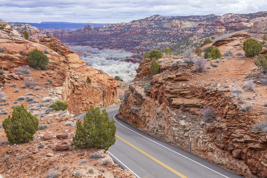
If you are looking for a unique road trip with enchanting national parks, great camping, and endless opportunities for outdoor adventure, stop what you’re doing and plan a Highway 12 road trip through southern Utah.
Our family has embarked on back road journeys all over America, but we happened upon Scenic Byway 12 in Utah by accident. Since that fateful day, we’ve been fueling our road trip dreams on the mere memory of our time there.
Highway 12 in Utah is a National Scenic Byway and has also been designated an All-American Road for a rustic landscape that isn’t found anywhere else on earth.
Driving Highway 12 is truly an epic experience and one of the most memorable visual feasts in America, bringing you through landscapes so ruggedly desolate that the drive alone is an experience worth reading about.
But there’s more to Utah Scenic Byway 12 than extraordinary beauty as viewed from the window of your road warrior machine.
Your journey could be extended for weeks and weeks as you explore two national parks, three state parks, and millions of acres of national recreation and forest lands. Highway 12 in Utah is one of our favorite road trips for couples and families!
Ready to plan your adventure on Highway 12 in Utah? First, there are some practicalities, and then the good stuff!
Table of Contents
Highway 12 Utah Map
When is the Best time to Drive on Highway 12 in Utah?
The best time to drive this stunning route is in October, when the weather is dry and days and nights are cool. March and April are lovely, too, and you will see more vegetation and flowers blooming in the spring.
Highway 12 is passable year-round unless there is a major snowstorm, but the white-knuckle driving in winter makes the road unpleasant to drive on. Summer, while hot, is beautiful in the canyons and, honestly, not as crowded as I would have thought.
What’s the Best Way to Get to Scenic Byway 12?
If you have to fly in and rent a car, you will be driving just under four hours to get to Panguitch, where your Highway 12 journey begins. It’s a toss-up between using McCarran Airport in Las Vegas or Salt Lake City International Airport, so do your research beforehand and find the best deals on flights and car rentals before booking.
How Long Should I Spend Driving on Highway 12 in Utah?
From a technical standpoint, you could drive Highway 12 in a single day, but what would be the fun in that?
To take full advantage of the recreation opportunities, I recommend spending 2-3 nights in Bryce Canyon National Park, 1-2 nights on Highway 12 (we’ll list more suggestions below), and 2 nights in Capitol Reef National Park for a 5-7 day road trip with lots of hiking and exploring.
Will I Have Access to Amenities on Highway 12?
There are grocery stores and gas stations at either end of Route 12 and a few more gas stations along the route. I suggest getting all of your provisions and filling your tank in Panguitch before heading east. There are small stores in both Bryce Canyon and Capitol Reef National Parks.
The Best Stops: Highway 12 Utah Road Trip Map
Here are some highlights of this fabulous road trip on Scenic Byway 12 – an absolute must for everyone who wants to fall hopelessly in love with the open road.
Panguitch and Red Canyon
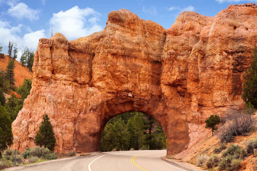
Traveling from west to east, you will begin your foray into the little town of Panguitch. A historically rich village that is steeped in the weather-beaten charm of the Wild West, Panguitch is the place to stock up on provisions, throw back a drink at an authentic saloon, or embark on a historical walking tour.
Just 25 miles from Bryce Canyon, Panguitch boasts a growing tourist economy while maintaining its small-town roots.
From Panguitch, you will enter Red Canyon, where the excitement begins.
Turn up your favorite tunes and prepare to be amazed at the pillars, pinnacles, and spires that stretch out for miles and offer jaw-dropping spectacles around every bend. The performance continues for miles, but the red rocks will entice you to get a closer look before you’re too far into your journey.
Your first stop is not far from Panguitch.
The Red Canyon Visitor Center is the perfect place to stretch your legs, learn more about the geological forces behind the landscape, and eat a picnic lunch.
You might want to take a leisurely stroll on the Pink Ledges Trail. It’s a short, interpretive hike from the visitor center near the picnic area that leads you through a conifer forest to the base of a red rock cliff.
Don’t forget your camera – even the cliffs around the visitor center are stunning!

If you’re into careening down a mountain on two wheels as the scenery blurs past and hikers run for safety, pull off at the trailhead of the Thunder Mountain Trail, just before the Red Canyon Visitor Center.
This is a world-class mountain biking destination, and when combined with the paved Red Canyon bike path, it is a great loop for experienced riders. At one point, the cliffs drop off on two sides, and you can see for miles in every direction. Just don’t look down.
Welcome to Bryce Canyon National Park
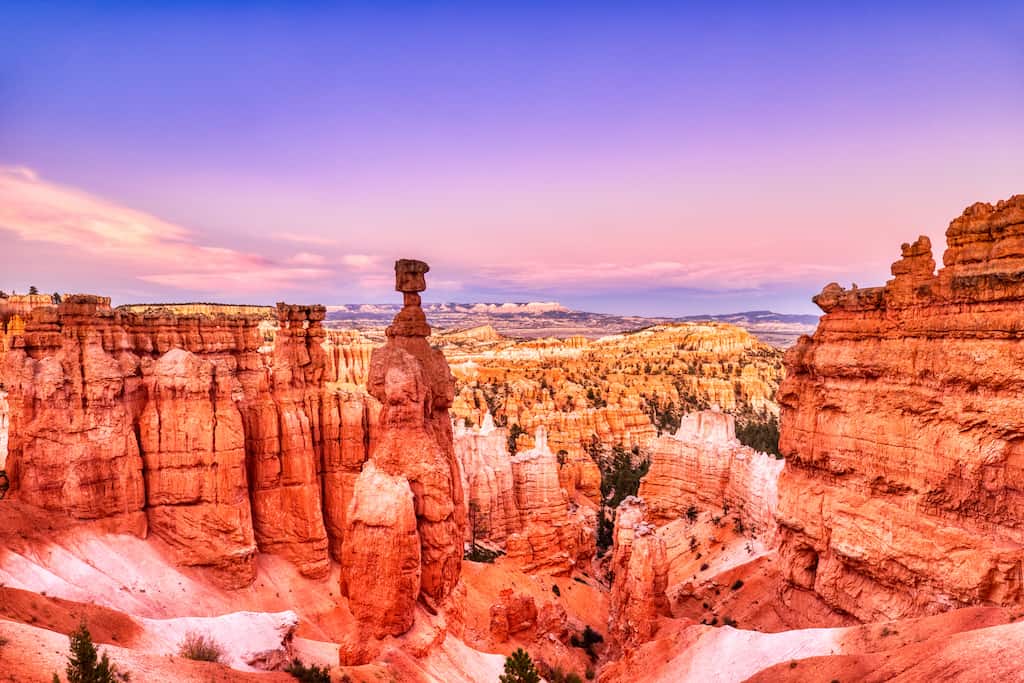
Sure, you can drive through Bryce Canyon National Park, stopping at all the vistas and taking some photos before heading on your way, but to really appreciate this otherworldly landscape, I recommend pitching your tent (or parking your Escape Campervan) for a couple of days.
If camping isn’t your thing, book a room at the Lodge at Bryce Canyon.
There are two campgrounds in Bryce Canyon National Park. Sunset Campground has 100 tent/RV sites that can be reserved between May 20 and October 15 on Recreation.gov. North Campground has 99 first-come-first-serve sites, 30 of which are open year-round.
During our recent visit, we scored the last campsite at Sunset Campground without a reservation, but we don’t recommend doing it that way!
If you make a point of getting up before the sun, you can watch it rise over the hoodoos and bathe the canyon in a rainbow of colors.
Then, before the campground comes to life and you head back down for your morning coffee, you will feel like you are the only one in the vast empty canyon, and you’ll embark on a life on the road, changed forever.
Okay, that’s just my little fantasy, but Bryce Canyon and this particular road trip rocked my world in the best possible way.
Also, please take advantage of the ranger-led night walk if it is offered during your stay.
There are full-moon hikes and astronomy programs that will leave you breathless. On a clear night, the Milky Way shines like a silver streak across the heavens, and 7500 stars are visible to the naked eye.
You can also sign up for a three-hour guided tour of Bryce Canyon, where you can visit the most scenic spots in the park and learn about the impressive history of the area.
Best Vistas and Trails in Bryce Canyon National Park
With only a couple of days to explore this magical place, you want to hit the best vistas and trails before heading on your way. Here’s where we’d recommend going.
Visitor Center. Stop here to grab a map, learn about trail closures and special programs, and visit the museum.
Sunset Point and Navajo Loop Trail. If you only have time for one hike, do the 1.3-mile Navajo Loop, which will take you past some of the most stunning hoodoos in the park, including Thor’s Hammer, Wall Street, and Twin Bridges. This trail has an elevation change of 515 feet.
Fairyland Loop. The 8-mile Fairyland Loop will take you most of the afternoon, but it is a great way to get into the canyon without the crowds, and the scenery is gorgeous.
Rim Trail. 5.5 miles one-way; the Rim Trail is a paved path between Fairyland Point and Bryce Point, with numerous viewpoints and vistas from above the canyon. If you want to walk a portion of the Rim Trail, walk the mile between Sunset and Sunrise Point.
Kodachrome Basin State Park
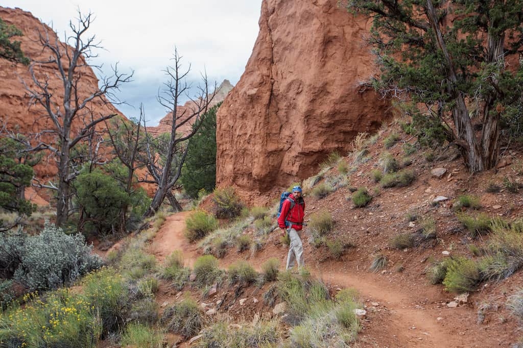
The vibrant colors within this Southern Utah landscape prompted a National Geographic Society expedition to name the area Kodachrome in 1948 after the popular color film. Today, it is Kodachrome Basin State Park, one of the best state parks in the US for slot canyons and arches.
Towering monolithic spires and chimneys rise from the valley floor or protrude from the sandstone rocks throughout the park. The towering rock formations range in height from three feet to 170 feet tall.
I recommend hiking Angel’s Palace Trail (1.5 miles) to take in the vibrant colors of this special place.
There are three small campgrounds in Kodachrome Basin State Park. Some are reservable, and others are first-come, first-served. This is just a half-hour from Bryce Canyon, so you can also visit as a day trip if you are staying in the national park.
Escalante Petrified Forest State Park
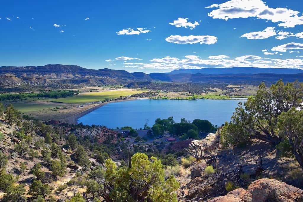
Travelers on Scenic Byway 12 in Utah often pass this park by in favor of more majestic and popular scenic attractions, but this quiet underachiever has some secrets to share if you give it half a chance.
At Escalante Petrified Forest State Park, you will find a small 22-site campground, a reservoir for bird watching, canoeing, and swimming, and some cool geological wonders.
While this petrified forest is less impressive in color and magnitude than the Petrified Forest National Park in Arizona, Escalante’s beauty lies in its obscurity and opportunities for solitude.
Two short trails snake through the park. The first is Petrified Forest Trail, which climbs up behind the campground and offers panoramic views of the surrounding park. The Trail of Sleeping Rainbows is a bit steeper with larger petrified specimens.
In July, when we passed through, we shared the whole park with one other camper. Day use is $10, camping is $25 or $30 with hookups. Campsites can be booked in advance.
Coffee with a View and a Pueblo Village
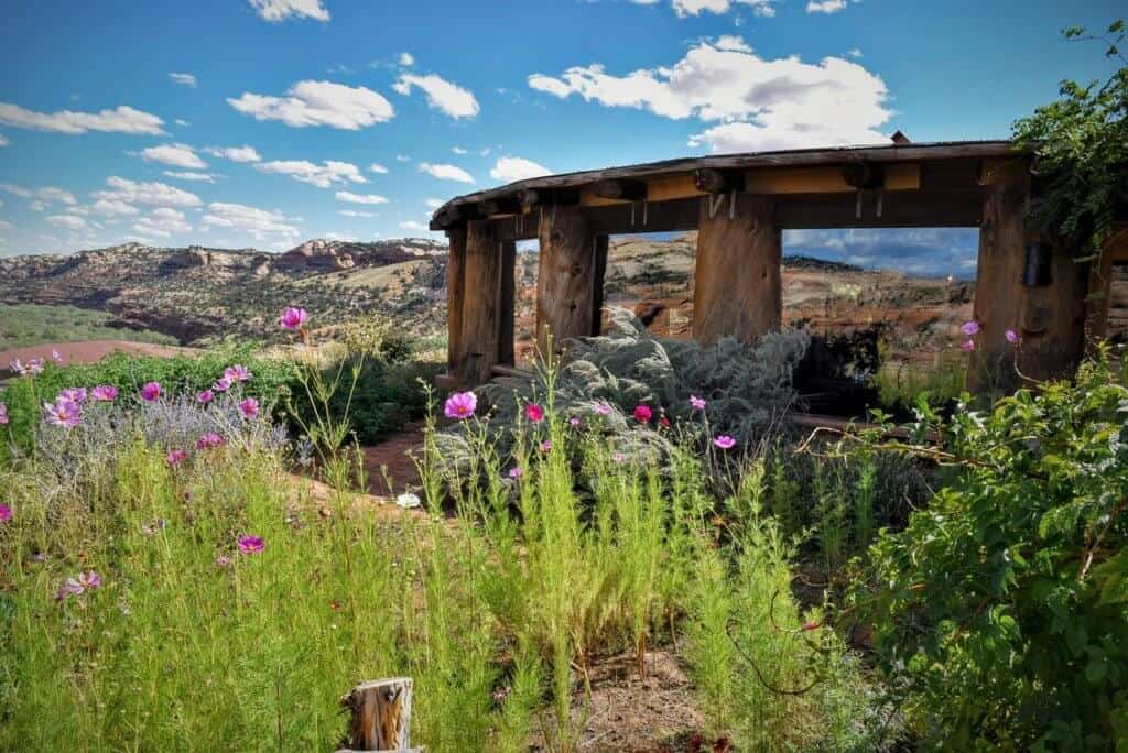
Heading east on Route 12 in Utah, you will just start to get into your driving groove when you spot a sign for coffee. The magnetic pull of the road may be too strong for you to resist, but I urge you to pull off and visit Kiva Koffeehouse.
This one-of-a-kind building is modeled after a traditional southwestern kiva, and it’s perched on the side of a cliff with expansive views of the canyon.
Moreover, the coffee is really good, especially if you’ve been drinking gas-station mud since San Francisco. On this particular road trip, our family had a thing about visiting coffee shops. They were our weakness and a source of comfort, especially in foul weather.
Anyway, by the time we reached Kiva Koffeehouse, we hadn’t had a decent cup since the coast, and we didn’t have high hopes for remedying the situation anytime soon. We were happily surprised by the quality of the pastries and the coffee at Kiva, and we were stunned by the beauty of the building and the amazing views.
Kiva Koffeehouse is open Wednesday through Sunday from 8 am to 4 pm. They are closed in the winter (between October and May).
Calf Creek Falls and Anasazi State Park Museum
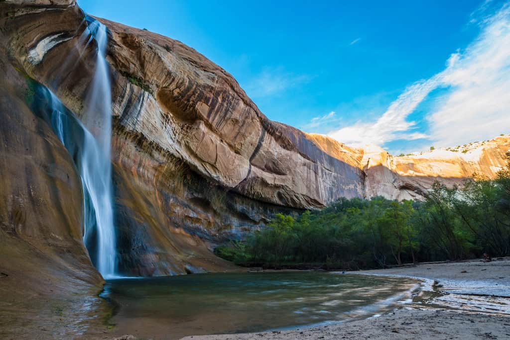
Time for another hike! If you are road-tripping during the warmer months, you will want to stop at Lower Calf Creek Falls for a little dip before continuing on your way. It’s 6 miles round-trip, but the path is relatively flat and easy.
A clear stream descends 126 feet into a pool for swimming. Mist from the falls and shade keep this spot cool even on the hottest days. There are many points of interest on the trail worth checking out, including a beautiful pictograph on the canyon wall. Take your time with this one.
Your next stop is the Anasazi State Park Museum. This small museum and reconstructed Anasazi village is a quick and interesting spot, perfect for your picnic lunch, and especially fun if you have kids.
The museum contains authentic pottery and several artifacts that were excavated on-site.
The Anasazi, or Ancestral Pueblos, occupied the spot from 1050 until about 1200. The village combines original excavation and reconstruction and is very well done, making it a perfect side trip for history buffs and homeschoolers like us.
Boulder Mountain (Bluebell Knoll)
Time for a little dirt road detour. From Highway 12, turn left onto Forest Service Road 177 (which turns into 178) and take a scenic drive to Boulder Mountain (11,313 feet above sea level) in Grand Staircase-Escalante National Monument.
With a nearly flat summit of roughly 70 square miles, this road and mountain provide gorgeous views without having to hike for them.
The mountain is also the highest-timbered plateau in North America and is part of the Dixie National Forest. The high-elevation roads to Boulder Mountain are open seasonally, usually between July and September.
There are many high alpine lakes in the area — perfect for another swim, fishing, or paddling. This scenic road is a fun detour before ending your Highway 12 road trip in Capitol Reef National Park.
Welcome to Capitol Reef National Park
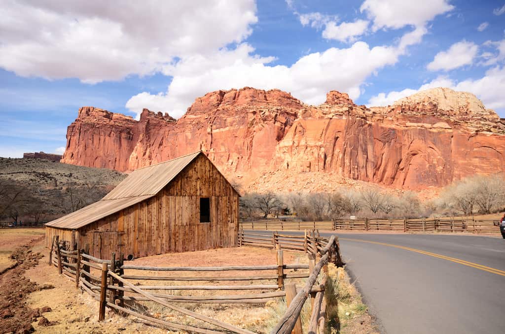
This epic stop on your Highway 12 adventure isn’t even on Highway 12, just to the east. Capitol Reef is Utah’s least popular national park, but it’s rich in history and full of charm.
Nomadic hunters inhabited the area before the Fremont people finally settled in 500 CE.
You can view petroglyphs from this time period from a boardwalk just a short walk from the parking area. It is incredible to think that this ancient art has stood the test of time and the elements.
Mormon pioneers settled the valley in the 1800s as a mission, planting abundant fruit trees and farming the fertile land. This settlement was short-lived, but the National Park Service still maintains the orchard.
The historic orchard at Capitol Reef is the largest in the national park system, with more than 3,100 fruit and nut trees.
The orchard is open to the public for picking, but we were a bit early for the harvest when we headed through in July. However, we scored a fresh-baked cherry pie and homemade ice cream at the Gifford Homestead store.
Fresh-baked pie when you’re living out of your car is a pretty big deal indeed.
The campground at Capitol Reef is small and unassuming, with a tiny river for swimming (we saw a snake in the water) and nice walking trails. The whole park has a hometown and leisurely feel to it.
The rangers, as usual, were awesome, and even in the busy July travel season, the crowds were minimal.
If you want to spend time exploring Capitol Reef National Park but don’t want to camp, consider Capitol Reef Resort, which is close to the park entrance and features amazing views.
You can choose from a standard hotel room, a teepee, or a covered wagon for your lodging. There’s also a casual restaurant on site, an outdoor pool and hot tub, and a fitness center.
Ready to plan your next road trip on America’s most scenic highway? Highway 12 in Utah promises endless opportunities for every type of adventurer!
Where to Stay on Highway 12 in Utah
We recommend book-ending your drive with stays at Bryce Canyon National Park and Capitol Reef National Park, but you should also consider spending one night between the two.
Camping at Escalante Petrified Forest State Park is a great choice; if you don’t want to camp, here are a few more ideas.
Budget option – Ponderosa Inn, Escalante. This small, unassuming motel has just five cozy rooms. It’s located in downtown Escalante and within walking distance of eateries.
Glamping – Ofland Escalante Looking for a special glamping getaway to celebrate this awesome road trip? Ofland Escalante is an upscale glamping resort with private cabins and Airstreams for rent. Amenities include a pool and hot tub, grab-and-go meals, a general store, and a drive-in theater. Pets are welcome for an additional fee.
Bed & Breakfast – Slot Canyons Inn. Choose from rooms, suites, or the Isaac Riddle Cabin on 160 acres near Grand Staircase Escalante National Monument. All rooms have an outside entrance, and breakfast is served daily.
What to Pack for Your Highway 12 Road Trip Through Southern Utah
Not sure what to pack for your Highway 12 road trip?
Go for 100% activewear, as you’ll be doing lots of outdoor adventuring and spending minimal time in town. Nightlife will include stargazing and marshmallow roasting, so leave the heels at home. Here are a few useful items to throw into your bag for this road trip.
- Clothes for hiking. You’ll be spending some time outdoors, so clothes that are rugged and comfortable are best. Opt for sturdy, non-cotton pants (like these) and a breathable, moisture-wicking shirt. I love Merino wool shirts because they keep you cool when it’s hot out and warm when it’s cold out; plus, they don’t stink like polyester blends, and they dry quickly.
- Sturdy shoes. You want your feet to take you wherever you need to go. Rugged hikers will work for visiting in every season and will protect your feet from spiny plants and creepy crawlies.
- Jackets. The weather in Utah is variable, especially since you will be exploring at different elevations. In the summer, you will be OK with a fleece and a windbreaker. For fall travel, add a down puffy jacket and a wool hat. These down jackets pack down small and are perfect for travel.
Need more adventures in the American Southwest? Read these next:
- The Best Things to Do in Lake Havasu City, Arizona
- Incredible Glamping Near the Grand Canyon
- Discover Oatman, Arizona, on Route 66
- Family Adventures in Joshua Tree National Park
Follow us on social media for more outdoor inspiration!

Tara Schatz is a freelance writer and travel blogger with a passion for outdoor adventures. She is the co-author of AMC’s Best Day Hikes in Vermont and currently blogs at Back Road Ramblers and Vermont Explored, where she shares travel tips, adventure destinations, and vacation ideas for the wanderer in everyone.

Greetings Tara, I truly enjoy and appreciate your travels, insights and scope of your blogs. Your writing is natural and very fact-friendly and complete!! I really enjoy how completely you cover your areas and side-lights!! Thank-you, Sincerely, AVP
Thank you so much! Your comment means the world to me!