Incredible Hikes Near Roanoke, Virginia
Note: Advertising is how we keep this site free for you to enjoy, and we earn a commission from affiliate links that may be included in this post. Thank you for supporting Back Road Ramblers!
Looking for a mountain town where you can spend your days hiking to summit views and your nights exploring local breweries and a vibrant, walkable downtown?
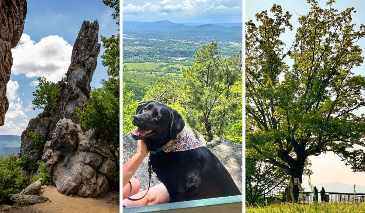
The ancient, rounded mountains surrounding Roanoke, Virginia provide the outdoor lover with an incredible array of trails, making it the perfect destination for your next hiking vacation.
For those of us who are self-described as “outdoorsy,” Roanoke is a playground just waiting to be discovered on foot, and visitors who enjoy careening down a mountain trail on two wheels will be equally impressed.
Make Roanoke your home base and explore the gorgeous Blue Ridge Mountains in your backyard. Check out some of our favorite hikes near Roanoke VA for your next Blue Ridge vacation.
Table of Contents
At-A-Glance: Hiking in Roanoke, Virginia
Best time to visit: April, May, and October for fewer crowds on the trails and less heat and humidity.
Where to stay: The Liberty Trust is a dog-friendly upscale hotel in downtown Roanoke. The rooms are so comfy, and there is a wonderful on-site restaurant called the Vault.
Best easy trail: Sawtooth Ridge along the Appalachian Trail is 1.9 miles round-trip with beautiful views.
Most epic view: Tinker Cliffs on Andy Layne Trail offers spectacular views if you’re willing to put in the effort.
Best hike in the city limits: Mill Mountain Star is iconic!
Planning a trip to Roanoke and Virginia’s Blue Ridge Mountains? Check out some of our other posts for the best things to do in this beautiful part of the world!
- The Most Fabulous Things to Do on the Blue Ridge Parkway
- 10 Perfect Things to Do in Roanoke, Virginia
- Get Outside: The Best Parks in Roanoke, Virginia
- Dog-Friendly Trails and Tasty Brews: A Weekend in Roanoke, Virginia
- 10 Outstanding Breweries in Roanoke, Virginia
I have been exploring Roanoke for many years, and it’s no secret that it’s one of my favorite mountain destinations. No matter how many times I visit, there are always new trails to check out, which keeps me coming back for more!
With a home base in Roanoke, you can explore lots of trails without having to drive very far (30 minutes, max), and if you give yourself a larger radius, you’ll have even more options (Peaks of Otter and Smith Mountain Lake come to mind).
Generally, I prefer to spend more time on the trail and less time in the car, so this list focuses on hikes near Roanoke, VA, within a 30-minute radius of the city. I’ve tried to include a nice mix of easy, moderate, and strenuous trails so that every outdoor lover will find a trail to fall in love with.
Insider Tip: I use AllTrails to find new trails, read reviews, and check weather conditions before hiking. Because cell service can be spotty in some areas, I use AllTrails Plus to download trail maps before leaving home. Use our referral link to save 30% off your annual subscription ($25.19 instead of $35.99).
Sawtooth Ridge on the Appalachian Trail: Salem, VA
Distance: 1.9 miles round-trip | Elevation change: 400 feet | Difficulty: Easy to moderate | Dogs: Yes | Cost: Free | | Trail Guide
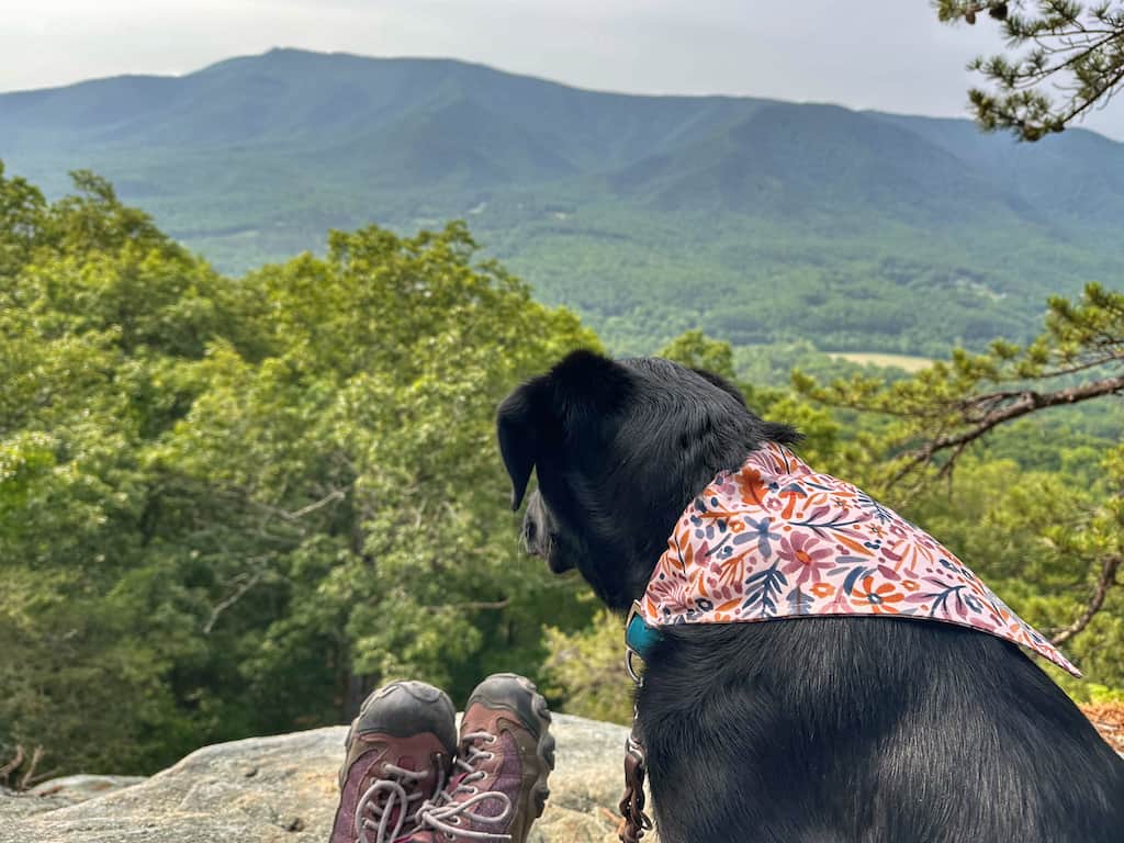
If you are looking for a lovely view achieved after a short hike on America’s most famous footpath, check out Sawtooth Ridge near Salem.
Park in the same lot used by the throngs of hikers heading up to McAfee Knob, but instead of hiking 8 miles, round-trip, this hike clocks in at just under 2 miles.
It’s a gentle uphill climb to a rocky ridge with far-reaching views of the surrounding mountains. This is the perfect spot for a picnic, and it’s surprisingly quiet considering how crowded it is to hike north instead of south.
The hike to Sawtooth Ridge is one of my favorite easy hikes near Roanoke, one that I have done countless times. I especially love this trail in the spring when the mountain laurels are blooming along the trail.
I recommend taking the McAfee Knob hiker’s shuttle on the weekends. It’s $5 each way, and dogs are not permitted. Here’s an overview of alternative parking suggestions for Sawtooth Ridge and McAfee Knob.
McAfee Knob on the Appalachian Trail: Salem, VA
Distance: 8 miles round-trip | Elevation change: 1,700 feet | Difficulty: Moderate to difficult | Dogs: Yes | Cost: Free | | Trail Guide
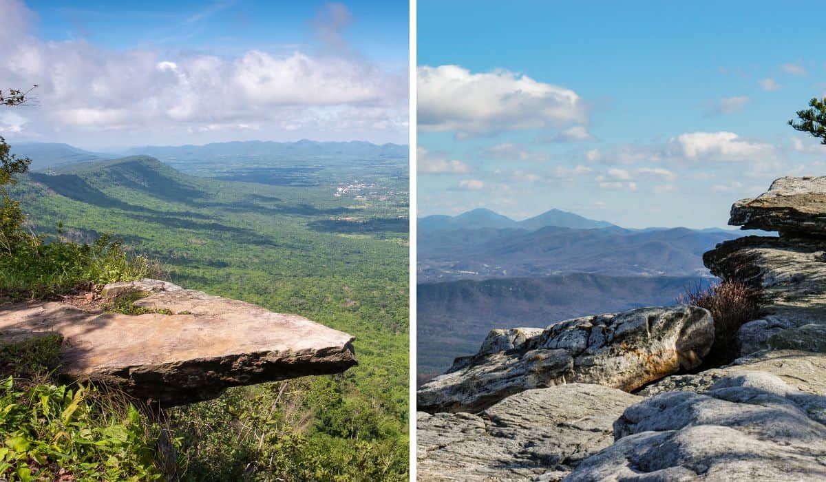
The hike to McAfee Knob is easily the most iconic in the area, with an exhilarating climb and a lot of company on weekend treks. Oh, and a pretty nice view of North Mountain, Roanoke Valley, and Catawba Valley.
The trail splits in two early on, and you can choose from an old fire road known as the McAfee Knob Trail or the steep and narrow Appalachian Trail. The footing is easier on McAfee Knob and better for group hikes and downhill walking, but I find the AT more interesting.
While the famous rock protrusion is one of the most photographed spots on the whole Appalachian Trail, you’ll find lots of spots to spread out and relax, even among all the people sharing the gorgeous view.
McAfee Knob is one of the hikes in Virginia’s Triple Crown, which includes Tinker Cliffs and Dragon’s Tooth. All three can be completed in a backpacking weekend, but I’ve yet to tackle that adventure. Read more about this 37-mile loop that includes the Triple Crown and North Mountain at 57 Hours.
As with the hike to Sawtooth Ridge above, you will need to find alternative parking while the pedestrian bridge is being constructed.
Tinker Cliffs: Troutville, VA
Distance: 7.2 miles round-trip | Elevation change: 1,945 feet | Difficulty: Strenuous| Dogs: Yes | Cost: Free | | Trail Guide
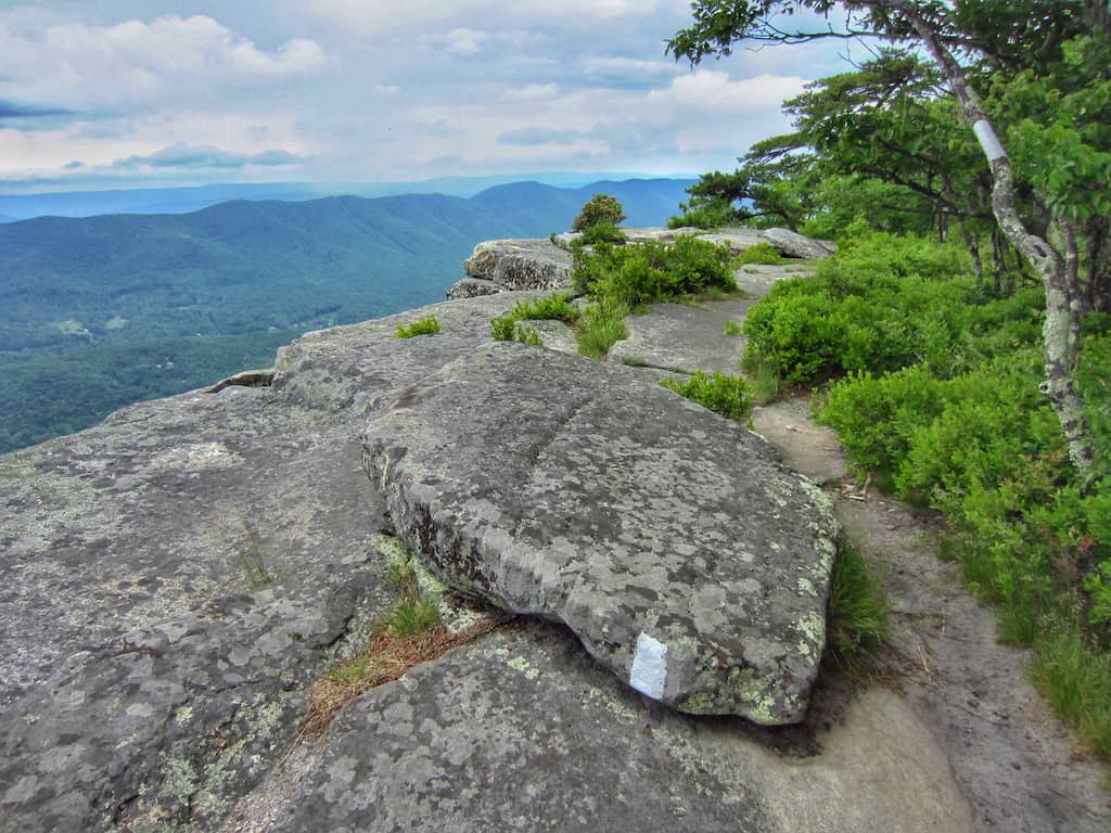
Of the three Triple Crown trails, I love Tinker Cliffs best.
The Andy Layne Trail takes you through several cow pastures (I love cows), across a few streams, up way too many steps, and past numerous vistas. The only downside to this hike was the bugs at the top of Tinker Cliffs (in April).
Tinker Cliffs was also the hardest of the Triple Crown trails, but the varied landscape and lovely views made up for the huffing and puffing. As with all of the Triple Crown Hikes, I recommend getting to the Andy Layne parking lot early, especially on the weekends.
I’ve never had two cars in Roanoke, but if you’re local, you can do Tinker Cliffs and McAfee Knob as a point-to-point hike totaling 13.4 miles. I think that would be a perfect day as any I’ve experienced.
Dragon’s Tooth: Catawba, VA
Distance: 4.5 miles round-trip | Elevation change: 1,300 feet | Difficulty: Strenuous| Dogs: Yes | Cost: Free | | Trail Guide
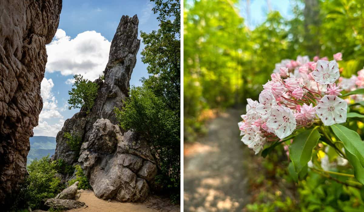
I’ll preface this description by readily admitting that I did not hike to the top of the iconic Dragon’s Tooth as I was scared!
However, the views were gorgeous without risking my life, and there is still a good deal of rock scrambling before reaching the summit. In fact, the scrambling makes this a fun trail, and the miles will disappear before you know it.
The ‘tooth’ is a 35-foot rock spire perched on top of Cove Mountain. I’ve heard that it’s actually easier than it seems, so I may give it a second go next time I’m down in Roanoke. For me, climbing up the rock scramble was fun, but going down was a little disconcerting. I recommend going backward on the scrambles and taking it really slow.
This whole hike took me more than six hours, but I am a slow hiker. For many, this is a favorite of the Triple Crown Trails, but I still like Tinker Cliffs better. Let me know what you think if you try them.
Buzzard Rock on Read Mountain: Cloverdale, VA
Distance: 3.2 miles round-trip | Elevation change: 850 feet | Difficulty: Moderate | Dogs: Yes | Cost: Free | Trail Guide

Located just seven miles north of Roanoke, this 243-acre preserve is tucked away behind a small residential area and features five miles of trails that are both quiet and peaceful most of the time.
Take the Buzzards Rock Trail from the parking area that leads to the summit of Read Mountain, known as Buzzards Rock.
You’ll likely see said buzzards, but also fantastic views of the valley and mountains beyond.
There are a few picnic tables at the trailhead, or you can haul your launch up to the summit and dine with the buzzards. Bring water for yourself and for your dog, as this is a dry trail.
Mill Mountain Trail in Mill Mountain Park: Roanoke, VA
Distance: Varies, the loop I did was 3.5 miles | Elevation change: 850 feet | Difficulty: Moderate | Dogs: Yes | Cost: Free | Trail Guide
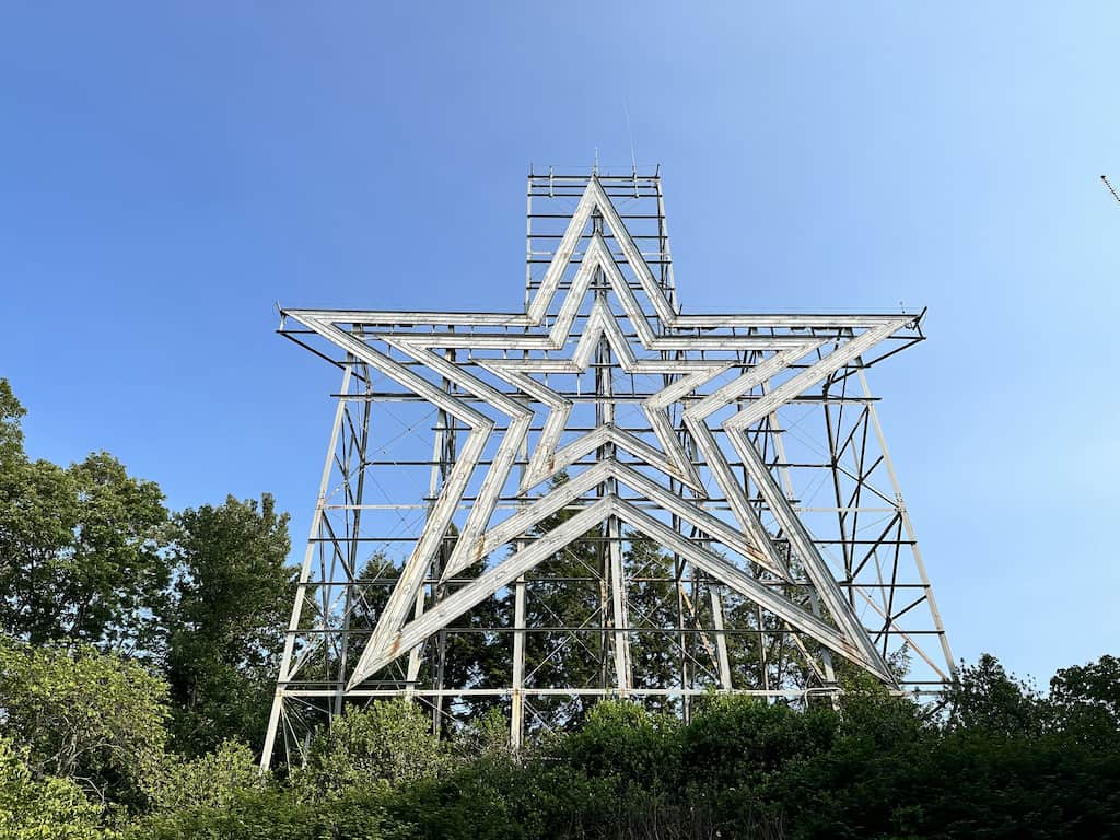
Since it’s home to the famous Roanoke Star, Mill Mountain Park is likely the most well-known and beloved park in Roanoke, and I’d also argue that it is one of the most beautiful.
Located right off the Blue Ridge Parkway and less than five minutes from downtown Roanoke, Mill Mountain Park is perfect for a leisurely stroll or a rugged hike.
Hike to the star on the aptly named Star Trail, which is 1.7 miles long (one-way) and climbs 850 feet in elevation.
If hiking isn’t in the cards on your trip, you can drive to the top of Mill Mountain and walk a few hundred feet to the star and overlook.
The Roanoke Star was built in 1949 as a Christmas decoration sponsored by the Roanoke Merchants Association. Because of its popularity, this temporary mountain exhibit now graces Mill Mountain year-round and is illuminated every night of the year. It is 88 feet tall, contains more than 2,000 feet of neon tubing, and weighs more than 10,000 pounds.
The Roanoke Star can be seen from all over town, and because of it, Roanoke will forever be known as the Star City of the South.
Poor Mountain Preserve Loop: Roanoke, VA
Distance: Varies, the loop I did was 3.5 miles | Elevation change: 850 feet | Difficulty: Moderate | Dogs: Yes | Cost: Free | Trail Guide
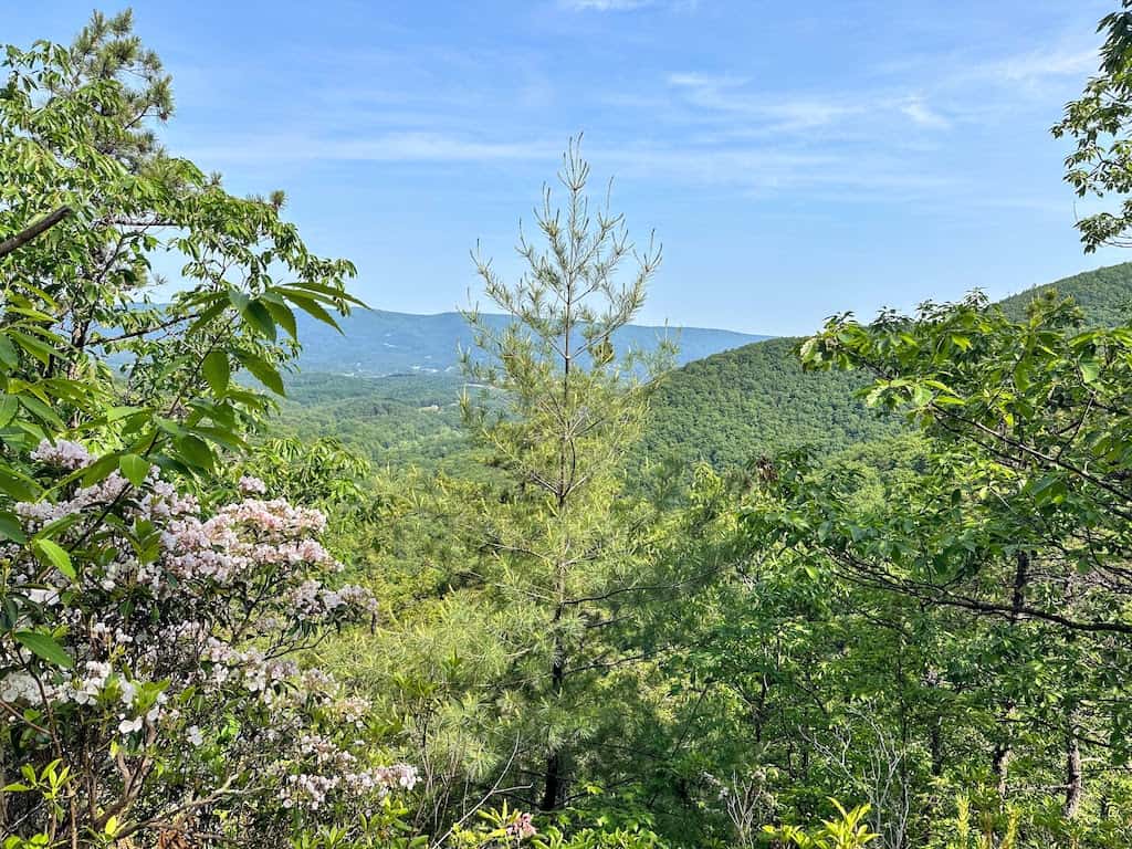
Poor Mountain Preserve is another quiet trail system that will take you deep into the woods, over a beautiful stream, and past a small but lovely waterfall.
This is not a trail for big views or crowds of people. Instead, it’s a spot for quiet contemplation, beautiful wildflowers, and lots of plant diversity.
Poor Mountain protects the world’s largest population of piratebush, a globally rare shrub, which is restricted to only a handful of sites in the mountains of Virginia, Tennessee, and North Carolina.
When I visited, I had no idea what piratebush looked like, but I compared screenshots on my phone to several suspect bushes in real life and eventually learned how to identify it. The mountain laurels and blueberry bushes were blooming heavily in May, and I could have spent the whole day admiring them.
While these trails may not be the most exciting of the hikes near Roanoke, they are a great choice for weekend hiking with minimal crowds.
Roanoke River Greenway: Roanoke, VA
Distance: 14.2 miles, but you can start and stop in several places along the trail | Elevation change: nominal | Difficulty: Easy | Dogs: Yes | Cost: Free | Trail Guide
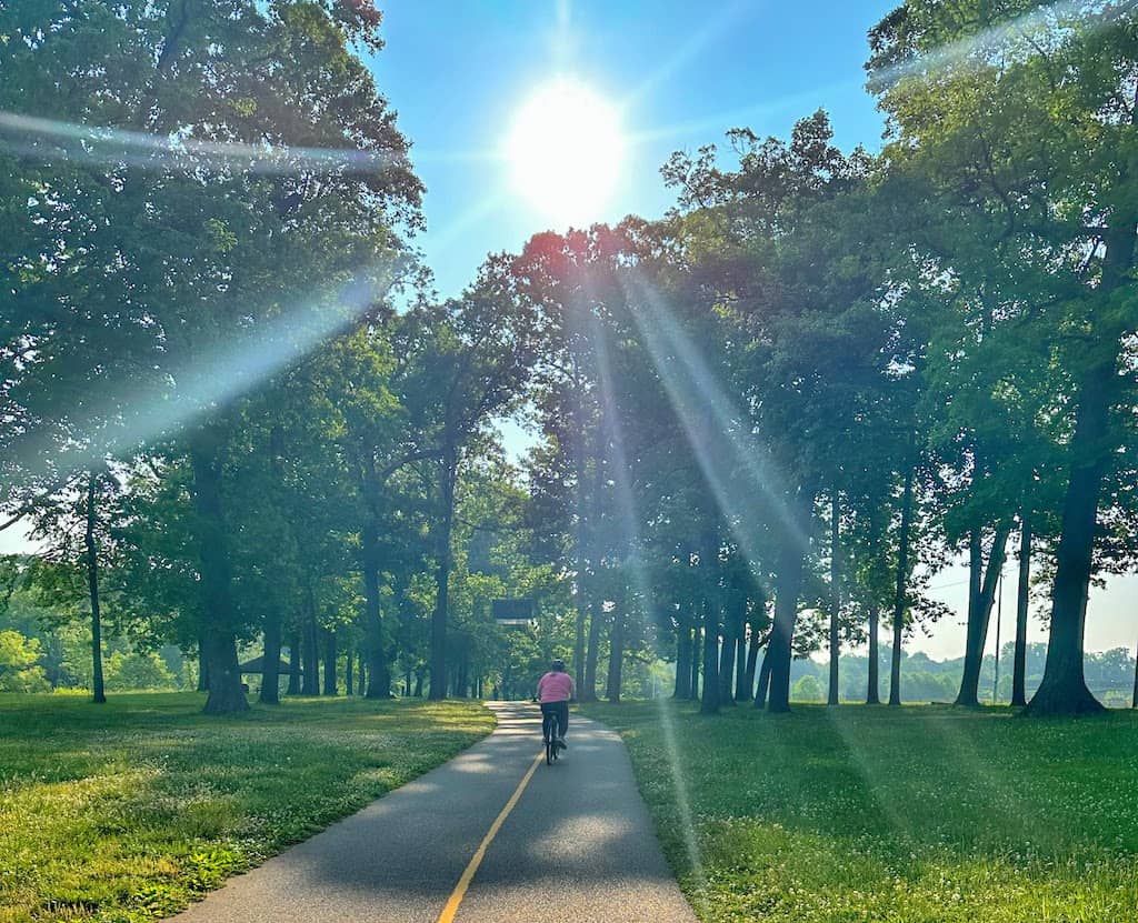
This universally accessible, paved pathway is a Roanoke gem — beloved by joggers, dog walkers, cyclists, and families. There are currently nine access points along 14.2 miles of greenway, so you can easily hop on and off to design a walk that works for you.
During my recent visit, I parked at Vic Thomas Park and walked as far as the Green Goat for lunch. This is a scenic area that hugs the river, passes several outdoor sculptures, and meanders through Wasena Park with playgrounds, pavilions, and a skate park.
This section of the Roanoke River Greenway would make a great family outing, and is great for dogs too.
Tips for Hiking Near Roanoke, VA
- Bring the 10 essentials: These 10 essentials should live in your day pack so you’re always prepared. I keep my bag packed and ready so that on hiking day, I just have to throw in my camera and some snacks.
- Wear the right clothing: Check out this post detailing some of the gear and clothing I love for hiking in the eastern mountains.
- Download your map on AllTrails: If you get AllTrails Plus or Peak you can download your trail map before your hike so that if you lose service, you can still stay on track.
- Tell someone where you’re going: I did a lot of solo hiking this year, so I made a habit of texting my husband from the trailhead before and after my hike each day. I hope the habit sticks!
- Plan for unpredictable weather: This goes along with the 10 essentials, but be sure to pack an extra pair of socks and an extra layer, as the weather can change quickly.
What hikes near Roanoke, VA, would you add to this list, and which ones should we check out on our next visit? Leave us a comment below!
Follow us on social media for more outdoor inspiration!
